
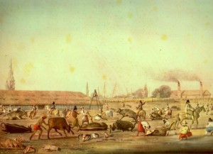
Impression of a Buenos Aires slaughterhouse by Charles Pellegrini, 1829.
[First Published on the NiCHE Website] By Andrew Watson with Jim Clifford For the past two weeks I’ve been in Saskatoon, working with Jim Clifford in the University of Saskatchewan’s Historical Geographic Information Systems (HGIS) Lab. Since January 2014 I’ve been working with Jim and Colin Coates on the Trading Consequences research project thinking about how historians can use these valuable new text mining, database and visualization tools to understand the economic and environmental histories of global commodity flows during the nineteenth century. This trip to Saskatchewan has allowed Jim and I to focus our energies on using Trading Consequences for historical research. We used text-mined spatial data in conjunction with trade statistics and textual sources as a means of testing the search results and functionality of Trading Consequences. To do this, we chose a case study: the history of leather tanning related commodities during the nineteenth century.
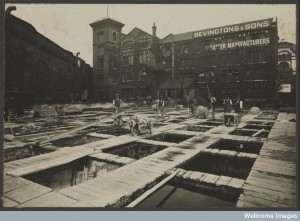
Neckinger Leather Mills Wellcome Images on Flickr Creative Commons by-nc-nd 2.0 UK
We chose leather tanning for our case study because this topic intersects with both our research interests. Jim is interested in how industrial development across London, including the leather district of Bermondsey, contributed to broader environmental transformations through the development of global commodity flows. Part of my recently completed doctoral research examined the economic and environmental dimensions of hemlock bark harvesting for leather tanneries in Muskoka, Ontario during the same time period. Trading Consequences provides the opportunity to learn more about the ways tanneries in Muskoka and London functioned as part of transnational networks in hides, tannins and leather. Apart from some primary and secondary source background reading, our work over these initial two weeks of research on this project focused almost exclusively on exploring nineteenth century trade statistics for Britain and, to a lesser extent, the United States. Theses statistics came mainly from the Annual Statement of the Trade of the United Kingdom with Foreign Countries and British Possessions, which the HGIS Lab’s research assistant, Stephen Langlois, entered into a Commodity Flows database. With the help of Jon Bath, Director of the Digital Research Centre at U Sask, Jim and I exported the statistics from the Commodity Flows database to create spreadsheets, graphs and maps, which we used to help us understand broad patterns and trends in the global trade of leather tanning commodities during the nineteenth century. One of the tools we used to start to get a sense of the transnational connections of these commodities is SourceMap.com, a web-based supply chain mapping service, that allows users to generate maps populated with directional flow information. Using the information from the Commodity Flows database related to where commodities originated as well as their destination, Jim created four maps representing the flow of leather tanning related commodities at different points in the nineteenth century.